The 4WD SLAM Radar car measures walls and draws a map
The 4WD SLAM Radar project is a small car that measures wall distances and displays a route map in a computer browser. It could help explore motion and sensing in a cardboard corridor. Map accuracy depends on the car’s movement estimate.
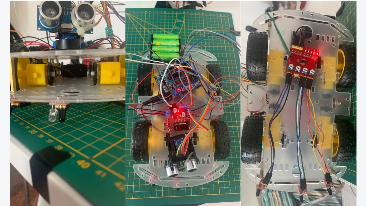
Three views of the project’s four-wheel car, front sensor, wiring and underside.
View full-size image
How does it find a wall?
Luca Fagioli built the project around an Arduino UNO R4 WiFi, a small computer that runs the control program. A front-mounted sensor sends sound above human hearing and estimates distance from the returning echo. A small motor turns the sensor left and right.
Where does the map come from?
The car sends distances and its estimated position over Wi-Fi to a browser page. That page draws wall points and lines. Despite the project’s Radar name, the distance measurement uses sound rather than radio waves.
What limits this example?
The program estimates movement from elapsed driving time; the wheels have no rotation-counting sensors. Slipping or getting stuck can therefore distort the map. The creator describes error-reduction measures, but independent position-accuracy measurements are not supplied.